Uluru – Icon of Australia


At the end of May 2017, Uluru stood as a silent sentinel over an historic summit of the First Nations of Australia. They had come from across the continent and the Torres Strait Islands, 250 community leaders. At the end of 3 days of deliberation, they issued a powerful and beautifully crafted document, entitled Statement From The Heart.  It rejected symbolic recognition. Speaking from the  “ torment of powerlessness” it demanded a constitutionally enshrined Indigenous voice in government decision-making. It also called for a Makarrata Commission to supervise agreements with government and lead the way to a treaty.

WomanGoingPlaces affirms its supports for the Uluru Statement.

This summit and the charter it produced added another dimension to the political, cultural and spiritual significance of Uluru.

Uluru is one of the few places in the world to have been awarded dual World Heritage recognition  – for both its outstanding natural values and outstanding cultural values.

On our trip to the Red Centre of Australia, we found extraordinary beauty, cultural richness, and new perspectives on this iconic Australian landmark.

We began with the perspective on Uluru from the distance,  at both sunrise and sunset. In the darkness of early morning, we watched as a dark shape outlined by the first rays of the sun began to loom over the flat plain. By day, we saw a monolith, 9.4k in circumference, rising up 348 metres from the semi-arid desert that surrounds it. Both the rock and the sand are stained a deep red by the iron oxide in the earth. Late afternoon, we watched from afar as the sunset coated Uluru pink, then rich purple colours.

But nothing really prepared us for the shock of seeing Uluru up close.

It is not a uniform lump of rock. As you walk into it, you discover oases with vegetation, waterholes, waterfalls, caves with rock art, gullies and rocks sculptured into remarkable shapes. Changes of light, shadow and perspective bring with them continuous shifts in appearance, an impression of movement at odds with the idea of a stolid monolith.

In the tranquility of the Kantju Gorge, we were enclosed by towering rocks that spectacularly changed from yellow to gold, orange to ochre, pink to purple, and brown to grey.

This breathtaking physical perspective is only a part of Uluru. We began to see that there is another more compelling perspective. We began to learn about the Anangu, the Aboriginal people who are the traditional custodians of Uluru and the country around it, and we pay our respects to them.  Their traditional languages are Pitjantjatjara and Yankunitjatjara. Carbon dating on caves, shows that indigenous people have lived in this area for at least 22,000 years, and possibly 30,000. Elsewhere in Australia, there is evidence of Aboriginal habitation dating back to around 60,000 years, making them one of the oldest human societies on earth.

Traditional custodianship is quite different from our concept of land ownership. It is not personal possession, but public, common responsibility to care for the land, its flora and fauna, and to carry on that care from generation to generation.

For thousands of years, the indigenous people have passed down the knowledge of how to survive on the land and how to survive as a community. But they have not written it down. There are no written texts. There is no sacred literature. They have no Bible, Koran, Sutras, Vedas or Chinese Classics that have guided the survival of other peoples.

It is an oral tradition that has sustained the Aboriginal people with a strong culture in Australia for 60,000 years, in some of the harshest terrain on earth.

The landscape is their sacred text.  The land is endowed with sanctity. Aboriginal spiritual heritage, history, laws, culture, knowledge, geography are all embodied in the land.  They read their land – its shape, its contours, its plants, animals and birds. And they express this connection to the land through songs, stories, ceremonies and art.

The foundation of the culture is called Tjukurpa – Creation – when the ancestors, changing shapes between humans, animals, birds and spirits, roamed the formless land. Their travels, battles and experiences gave shape to the land and created its distinctive topography and all life. As well as  creation stories, Tjukurpa is a body of knowledge governing human behaviour and care of country.

According to Tjukurpa, Uluru was formed by Two Boys. They were playing at the Kantju waterhole, piling up mud until it was the size of Uluru. The long channels and gullies on the southern side of Uluru were formed when the Two Boys slid down from the top on their bellies, dragging their fingers through the mud.

The python woman, Kuniya and the poisonous snake man, Liru, are other ancestors who shaped Uluru and left visible marks. Signs in the rock chronicle their struggle and the places where the grieving Kuniya struck Liru dead in vengeance for spearing her nephew.

When visiting Uluru, you are not just walking amongst boulders and rocks. You are following the path of the creation stories that the Anangu continue to celebrate. The spirits of the ancestors are believed to still dwell here so it is considered sacred, and parts of Uluru are closed to the public.

The initiation of the young into the complexities of Tjukurpa continues. And in caves in Uluru, grandfathers pass down knowledge to young boys, drawing on the cave walls as a teacher in any other classroom would illustrate on a blackboard. In separate caves, women elders pass on women’s business to young girls.

It is an ancient culture that is still alive and still defines the indigenous people.

Another new perspective we had on Uluru was looking up to the desert sky – the stark blue of the sky by day and the sheer brilliance of the night sky. Since tourist and local accommodation is concentrated in a particular area, the township of Yulara, electric lighting does not blot out the stars as it does in cities.  You can look up and clearly see endless swathes of stars shining directly above you.

Uluru is within the Uluru – Kata Tjuta National Park which covers 327,414 acres of Australia’s desert outback. In 1985 title deeds to the land were handed back to the Anangu, and it is managed jointly by the traditional owners and Parks Australia.

The Cultural Centre in the National Park is very beautiful. Built from mud bricks, it represents the two ancestral snakes, Kuniya and Liru. Inside, there are outstanding exhibits about Anangu culture, and you can purchase original indigenous artworks. The bookshop also provides information on a variety of walks around Uluru. Different tour companies also offer tours.

Since Uluru is a sacred site, climbing the rock is disrespectful. It is also dangerous, so visitors are requested not to do so.

The best times to go are during the Australian winter and spring, when the nights may be freezing, but the days are mild. In summer, temperatures can be extremely hot with outdoor activity limited to the morning hours.

The hotels all belong to one group so there is not much competition, but there is a range of accommodation from camping to 5-star tents and hotels.

Our photos were taken only where permissible. To see each photo separately go to our Gallery page.

Photography – Rosalie Zycher & Augustine Zycher

Video editor – Augustine Zycher

Music – Albare  CD  ‘The Road Ahead’  title track www.albare.info


Ningaloo Reef

Ningaloo Reef Australia for Women Travelers

How I came to swim amongst the magnificent corals of Ningaloo Reef with sharks, giant turtles, stingrays, dugongs and endless schools of dazzlingly coloured fish.

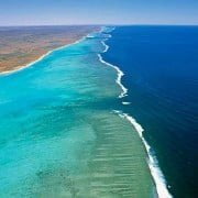
Everyone knows of the Great Barrier Reef off the east coast of Australia. Far fewer know of the Ningaloo Reef off the west coast of Australia. This is surprising given that Ningaloo was awarded World Heritage status and recognized as one of the most spectacular and last remaining pristine coral reef systems in the world. It is home to 220 species of coral and 500 species of tropical fish.

Ningaloo is actually one of the longest near-shore reefs in the world. It hugs a remote and isolated corner of Australia’s rugged north-west coastline.

I was intrigued to see a place so rich in unique marine wildlife and yet relatively unknown.

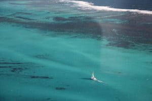
I thought the best way to see it was on a boat trip. So I booked myself in for a 5-day sail on a 52’ catamaran operated by Sail Ningaloo. By coincidence, the only other passenger on this trip was another woman, Kate from England, who travels extensively on her own on adventure boats trips to places such as the Arctic, the Antarctic and the Galapagos Islands. She was on the trip to do a lot of diving on the reef.

I chose to snorkel. I had never gone snorkeling before, but that didn’t matter. The crew showed me how to get into the wet suit and use the snorkel, slip over the boat and follow their lead underwater.
The turquoise waters were so immaculate, that valleys of exquisitely shaped coral were clearly spread out before me. And swimming all around me was an ever-changing and wondrous flow of fish of every size, shape and colour.
I have always loved seeing huge green turtles in nature documentaries. Now I was so excited to be able to swim in amongst groups of them and even get to within a meter of some of them. Until they realized I was there and flapped their fins and scurried away. Approaching two dugongs was very thrilling as these strangely shaped creatures are quite difficult to sight.

nigaloo reef sailingBut swimming with the sharks and stingrays was much scarier. I was told that the reef sharks are not interested in humans, but when several of them sped towards me, I froze in the water, until they swam by. The stingrays are much harder to spot, as they lie buried in the pure white sand on the bottom, then suddenly rise up, shake off their sand covering and quickly propel themselves away.
While lounging on deck, we watched whales swimming by, shooting streams of water through their blowholes. The white whales and humpback whales were on their annual migration through the 6000sq meter area of the Ningaloo Reef. One day, a mother humpback whale and her baby came right up to the boat. Kate and I stopped talking as we thought it would frighten them off, but just the opposite. The more we talked to them, the closer they got, until the mother whale swam under her baby and lifted him up on her back to give him a better look at us. They are highly intelligent and curious animals.

I was able to snorkel twice a day and yet each day I saw completely different arrays of coral formations, crustaceans, mammals and fish.

When not underwater, I lay on the deck and read, frequently looking up to spot whales, Manta rays, dolphins or turtles.

The best part of lying in the bunk in my cabin, was watching the sunrise light up the sea outside my porthole.

This is a woman-friendly tour. Even though I was doing things I had never done before, I felt safe, comfortable, and was not made to feel awkward or out of place as a woman traveling on my own. It was a very good way to access and enjoy the exceptional beauty of this part of the world.

Single supplement: it is sometimes waived for last minute bookings on a confirmed tour.

Sail Ningaloo recently won a Silver Award for Ecotourism and a Bronze Award for Adventure Tourism from Western Australia Tourism.


Go snorkelling and swim with dugongs, turtles, stingrays, sharks and gloriously coloured fish in amongst stunning coral formations. Take a look at the video footage.

Thanks to Sail Ningaloo and Prue Johnson for the underwater photos and video footage. Editing by Augustine Zycher.


More information:
http://www.sailningaloo.com.au

View Larger Map


Port Arthur, Tasmania

Port Arthur is a place full of contradictions.

At first glimpse, it gives the impression of an English stately home set in rolling hills and lush gardens beside an idyllic harbour. In reality, it was one of Britain’s most fearsome penal colonies that enslaved, brutalised and killed convicts during the 19th Century.

It was a place of terror, as intended by its founder, Lieutenant-Governor George Arthur – a place of hard labour, harsh punishment for infringements, and unremitting surveillance. The slave labour of the convicts was used to build not only the infrastructure of Port Arthur, but also to create a manufacturing complex for the new colony.

At the same time, Port Arthur was the place where innovative penal practices were pioneered based on the principles of the renown prison reformer Jeremy Bentham. These included efforts to rehabilitate convicts through teaching them trades or farming.

Port Arthur was meant to deal with the most hardened recidivist convicts, those that other prisons could not subdue. But boys as young as 9 were also sent there. You can tour Point Puer island where the first juvenile prison in the British Empire was established. Young boys were kept separate from the adult male prison on the peninsula. These boys received some education, were taught trades, but were still made to labour.

When it was established in 1830, Port Arthur was intended to be escape-proof. Situated in a place of utter isolation on the Tasman Peninsula, far south of the main settlement in Hobart, Port Arthur was connected to the mainland by a mere strip of land less than 50 metres wide. A line of dogs, crazed by hunger, stalked the only escape route over land. The area was also completely surrounded by water. Few convicts knew how to swim, and they were also told that the waters were shark-infested. And yet some managed to escape.

Once the most inaccessible place in Australia, it is now the place most visited by tourists to Tasmania.

Port Arthur was a prison where new forms of punishment were practised. In addition to the usual range of physical punishments such as whippings and starvation, a range of psychological punishments were introduced.

As you enter the church, you are amazed at the beauty of its curved wooden pews and the white walls. Until it is pointed out that the pews were designed so that a convict praying could not see anyone else or be seen. Prison pews. They were to be tormented even as they were supposed to be spiritually uplifted.

There was a regime of sensory deprivation called the ‘ Silent Treatment’. A hood was placed over prisoners’ heads and they were forbidden to utter a word. The floors and walls were padded to stifle sound. Convicts were also incarcerated in solitary confinement in totally blackened cells for long stretches of time. Many prisoners in the Separate Prison were driven mad from the lack of sound or light. So it was convenient that  the mental asylum was situated right next door.

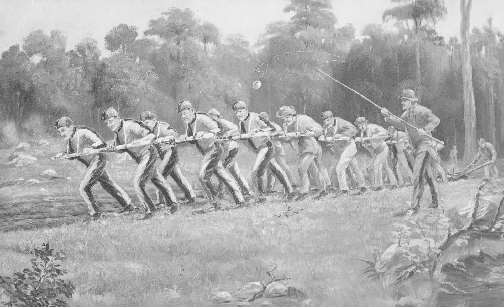
A convict ploughing team breaking up new ground at a farm in Port Arthur. Created circa 1838 by an unknown artist. Reprinted as a postcard circa 1926. State Library of Victoria

A convict ploughing team breaking up new ground at a farm in Port Arthur.
Created circa 1838 by an unknown artist. Reprinted as a postcard circa 1926.
State Library of Victoria

Port Arthur is now a World Heritage-listed site with over 30 buildings situated in landscaped gardens and a forest.

Take the time to see it properly because there is so much to see. You need time to experience the pleasure of looking at the natural beauty and the imposing structures built by convicts. There are faithfully restored buildings, some with period furnishings – such as the commandant’s residence, the doctor’s residence, the penitentiary and the church. Walking through these re-created homes lends an intimacy to the experience of history as you envision not only how the inmates lived, but also the lives of the officers, their wives and children.

In a novel approach to the site, when you arrive at Port Arthur you are allotted a card with the name of a real convict.  You are then able to follow the story and the fate of that inmate in an excellent interactive exhibition. This connection personalises the lives of individuals who suffered and lived there and who might otherwise be forgotten.

Port Arthur was closed in 1877 and for over a century its tragic history faded behind the beauty and peace of its surroundings. But exactly 20 years ago, once again the tranquility of this idyllic place was shattered by brutality and tragedy.

Port Arthur was the scene of a massacre in which 35 people, visitors and staff, were killed and 23 wounded. Tasmanian, Martin Bryant, was found guilty and given 35 life sentences without parole. The massacre prompted the Australian Government to subsequently introduce strict gun control laws.


Tasman Island Cruise, Tasmania

The boat is fast and the seas are often very rough. In the front rows, it’s the thrill of being on a roller coaster. The waves hurl you up and land you with a thump. From the middle rows to the back it is a more sedate ride – depending on the weather. So you get to choose what sort of ride you want, according to where you sit.

But wherever you sit, the views of the south-eastern Tasmanian coastline are spectacular.

WomanGoingPlaces was on the Tasman Island Cruise of Pennicott Wilderness Journeys.

Everyone in the boat was feeling exhilarated and filled with delight at the formidable beauty of the cliffs.

But suddenly, I was able to envisage how these same cliffs would have appeared to someone, 200 years ago. These cliffs would have been the first things the convicts from England saw of their penal colony of Van Diemen’s Land (Tasmania) where they would begin years, if not a lifetime of servitude.

As their ships sailed out of the fog, they were faced with massive sheer walls rising to
300 metres, the highest in the southern hemisphere. Grey, barren, dolerite rock compressed over 290 million years into narrow vertical pleats – frightening to their eyes, geological wonders to ours.

Our boat manoeuvres below archways, into deep sea caves and past blow holes and waterfalls. It floats beside platforms of rocks where countless nonchalant seals lie sprawled just above the waterline, eyeing us with different levels of interest. And then there is the wonderful feeling of freedom as we skim from one sea to another and back – from the Tasman Sea to the Southern Ocean that surrounds Antartica.

We had begun the tour with a bus trip from Hobart. As we passed through Eaglehawk Neck to Port Arthur, the driver told us about the infamous dog-line. In the 1800s, starving, savage dogs had been stationed along this narrow strip of land to attack convicts trying to escape from the nearby penal colony at Port Arthur to the mainland of Tasmania.

We alighted at a jetty and were fitted out with red waterproof jackets. We then boarded a sleek eco-cruiser, one of the Pennicott’s fleet of vessels customised to suit the rugged south Tasmanian coast. These open-sided rigid inflatable craft are 12.5 metres long with tiered seating for 43 passengers.

As we head out to sea, albatross circle close above our heads. Gannets, shearwaters, terns and fairy prions sweep over the waves. Sea eagles and falcons keep watch at the tops of the cliffs. Dolphins accompany the boat, but it is the wrong season to see migrating whales. This coastline and the abundant marine life and seabirds are all part of the Tasman National Park.

The variety of wildlife, the extraordinary beauty of the coastline, and the thrill of speeding over the water from one stunning area to another, made this the most marvellous experience.

This cruise, and the cruise to Bruny Island that Pennicott Wilderness Journeys also operates, have won multiple tourism awards.

* * * *

Photographs – Rosalie Zycher & Augustine Zycher
Video editing – Augustine Zycher

Music: Albare No Love Lost – The Road Ahead


Maria Island Tasmania

Cruising Maria Island

The boat pulled into the clear turquoise waters of a small cove. We were surrounded by rocks aged from 280 million to over 400 million years-old, pressed together in configurations seen nowhere else in the world. And then lunch was served.

WomanGoingPlaces was on a circumnavigation of Tasmania’s Maria Island. Maria Island has developed an international reputation for the 3-5 day walks held in this Tasmanian National Park. But we found that cruising the coastline is another way to visit the island.

We boarded the boat at Triabunna on the mainland and set out for a trip right around Maria Island. And we saw what makes this tiny island just off Tasmania’s east coast such a compelling place to visit.

Maria Island: Historical, Geological and Natural Wonder

Maria Island holds a remarkable position in Australian history. It is a refuge for Australian wildlife. It has great natural beauty, and is a geological wonder.

Before the colonial era, Aboriginal people journeyed regularly to Maria Island and evidence of their presence remains. Its earliest European visitors were whalers and sealers. Then in 1825, it became one of the first penal colonies set up by the British in Australia, even before the more infamous Port Arthur.

Today, it has become a ‘wildlife ark’ for threatened native wildlife.

It is one of the best places to see wombats, wallabies, pademelons and forester kangaroos in their natural habitat.  They roam undisturbed as no cars, shops or hotels are allowed on the island. There are over 114 bird species including introduced Cape Barren Geese. Our guide Kirsty lived up to her nickname “Wombat  Whisperer” when she led us close to several wombats, including a rare encounter with a mother and baby.

Tourists are allowed visits and short stays, but may not reside on Maria Island.

The complex beauty of Maria Island’s geological formations along the coast has left international geologists in awe. These formations are best viewed offshore by boat.

Our journey along the coast gives us spectacular views of the tall limestone Fossil Cliffs containing many ancient fossils, and the sandstone Painted Cliffs where iron oxide has stained the rocks with stunning splashes of colour – red on ochre and grey. We see rocks called Drop stones which 300 million years ago were dropped by glaciers.

Even the youngest rocks here were formed 100 million years before the dinosaurs.

The boat passes a waterfall cascading down rugged cliffs into the sea and remarkably stalactites formed on the outside of a cliff. We enter a deep cave studded with fossils. And even though it is dark, through the magic of the camera lens, cake-like layers of  bright pink, green, brown and golden rock are revealed.

There is an abundance of marine life including seals and dolphin. We were gazing across the water when suddenly a flying fish leapt out of the sea, its iridescent winglike fins spread taut as it flew  a metre above the water for about 15 metres before it dived back into the sea. We were too stunned to reach for our cameras, but fortunately someone on this boat had photographed just such a fish the previous week.

Spectacular white crescents and pristine bays of blue-green waters form the contours of Maria Island. We see immaculate beaches from the boat, and then at Darlington, we dock at one of them. These pure sandy beaches are composed of the same white granite as the world-famous Wineglass Bay on Tasmania’s Freycinet Peninsula.

Darlington

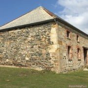
Darlington is the site of the World Heritage listed original convict settlement. We spent some time walking around. The British abandoned this settlement in the mid-1800s. Instead, the colonial rulers established the even more remote penal settlement of Port Arthur. Some of the original convict quarters are still standing at Darlington and are now used as dorms for travellers.

It is worthwhile to wander through Darlington’s remarkably well-preserved buildings. Besides the original convict buildings, are several impressive houses, including the Coffee Palace built by hopeful settlers in the 19th Century. Life was very harsh there and they failed to sustain their settlement. But they left a fascinating record. The testimonies of these entrepreneurs as well as those of such notable convicts as Irish nationalist leader William Smith O’Brien, exiled here for his part in the Young Irelander Rebellion of 1848, give Maria Island its rich mix of history and natural splendour.

* * * *

All photos by Rosalie & Augustine Zycher apart from Flying Fish by Karen Dick.

Music: Albare – No Love Lost from the album The Road Ahead